

One lat long converter for every format
GPS coordinates come in many shapes. A phone shows 40.689247, -74.044502, a hiking GPS shows N 40°41.355′ W 074°02.670′, a paper map uses degrees, minutes and seconds, the army uses MGRS, and a database may store a geohash such as dr5r7p62n. They can all mean the same spot. This GPS coordinates converter reads any of them and writes the point in all seven formats side by side, with a copy button for each.
You do not have to tell the tool which format you pasted. It recognizes the format by itself, shows how it read your text, and places a marker on the map so you can check that the point is where you expect. You can also go the other way: click the map, drag the marker or press "My location", and every format updates. To convert from one specific format, type into its row and press Enter.
Everything happens in your browser with formulas you can read below. No coordinate is sent to a server, which matters if you work with private locations. My tip: when a coordinate comes from someone else, look at the marker before you use the numbers. A swapped latitude and longitude, or a missing minus sign, puts the point on the wrong side of the world, and the map shows that at once.
The seven coordinate formats
Here is each format with the same example point, the Statue of Liberty in New York.
40.689247, -74.044502Latitude and longitude as plain numbers. North and east are positive, south and west are negative. This is what Google Maps, phones and most software use.
40.689247° N, 74.044502° WThe same numbers without minus signs, with a hemisphere letter instead. Easier to read aloud, and no risk of losing a minus sign.
40°41′21.3″ N, 74°02′40.2″ WEach degree has 60 minutes and each minute 60 seconds. Used on paper maps, in aviation, in land records and by many older GPS devices.
40°41.3548′ N, 74°02.6701′ WWhole degrees plus minutes with decimals. The default on many Garmin devices and the standard format for geocaching and marine navigation.
18T 580735 4504700Universal Transverse Mercator: the world is cut into 60 zones, and a point is given in meters east (easting) and north (northing) inside its zone. Used in surveying, GIS and topographic maps.
18T WL 80735 04700The Military Grid Reference System adds 100 km square letters to UTM, so a position fits in one short string. Used by NATO forces, search and rescue, and (as USNG) by US emergency services.
dr5r7p62nA short text code for a rectangular cell. Each extra character makes the cell smaller. Popular in databases and apps because nearby places share the same first characters.
87G7MXQ4+M5Google's Open Location Code: a code like an address for places without street names. Plus Codes work offline and can be shortened when a city is known.
How to convert coordinates, step by step
You can start from text, from the map or from your device's location. These steps show each way.
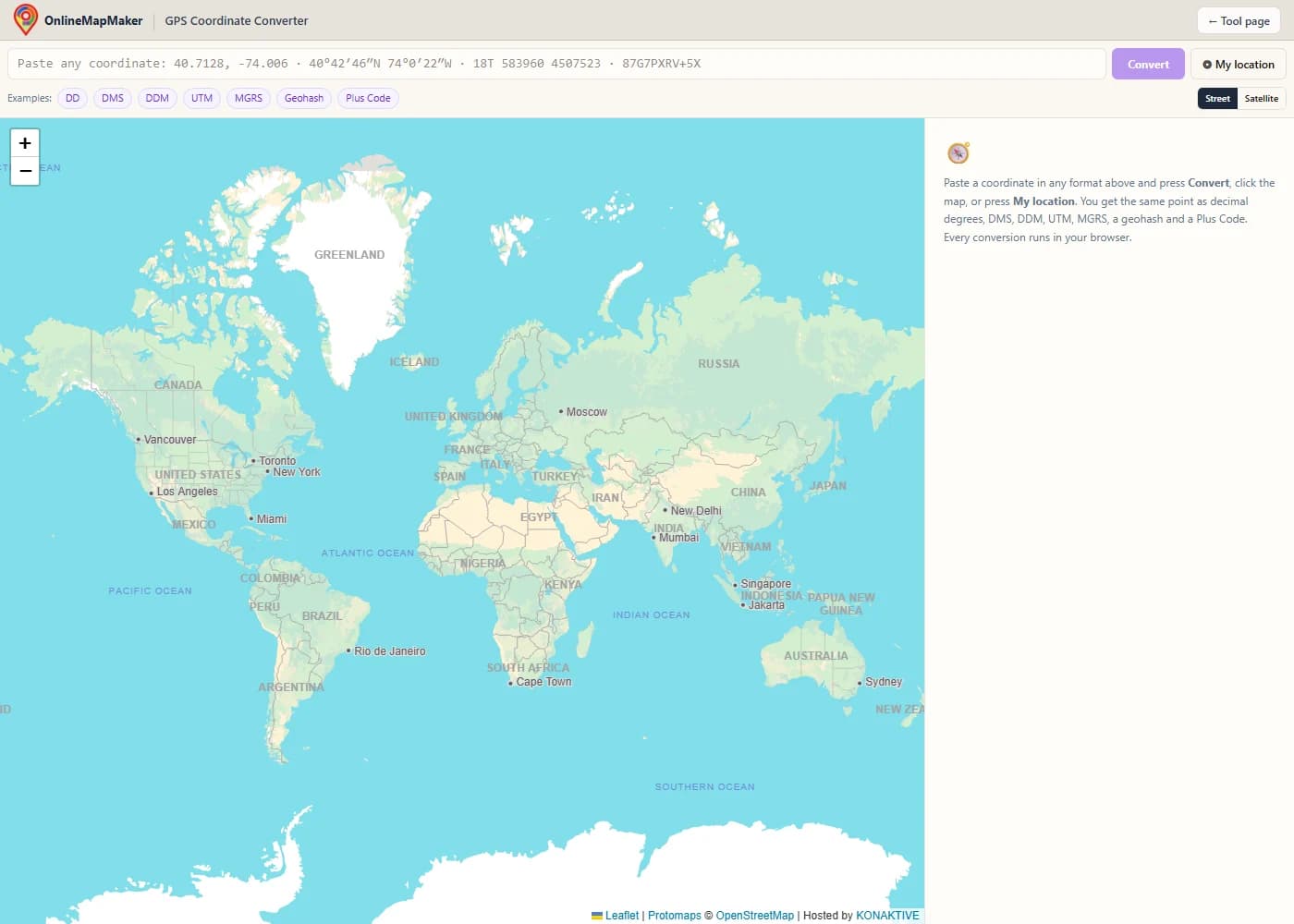
The world map opens with an empty results panel. The example buttons under the input box fill in a sample coordinate in each format.
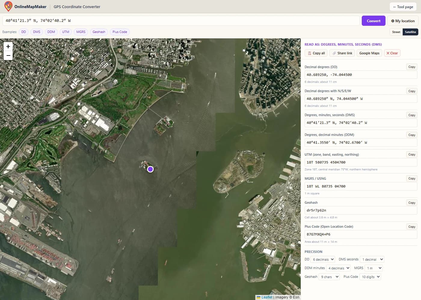
Paste a value and press Convert or Enter. Here the DMS coordinate "40°41′21.3″ N, 74°02′40.2″ W" is read as degrees, minutes and seconds, and the panel shows it in all seven formats, with the marker on the Statue of Liberty.
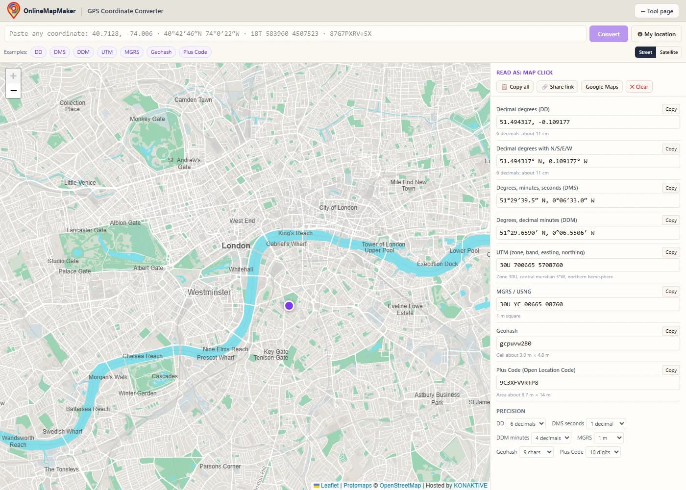
Click the map to convert that spot, or drag the marker to fine-tune it. All rows update at once. "My location" does the same with your device's position.
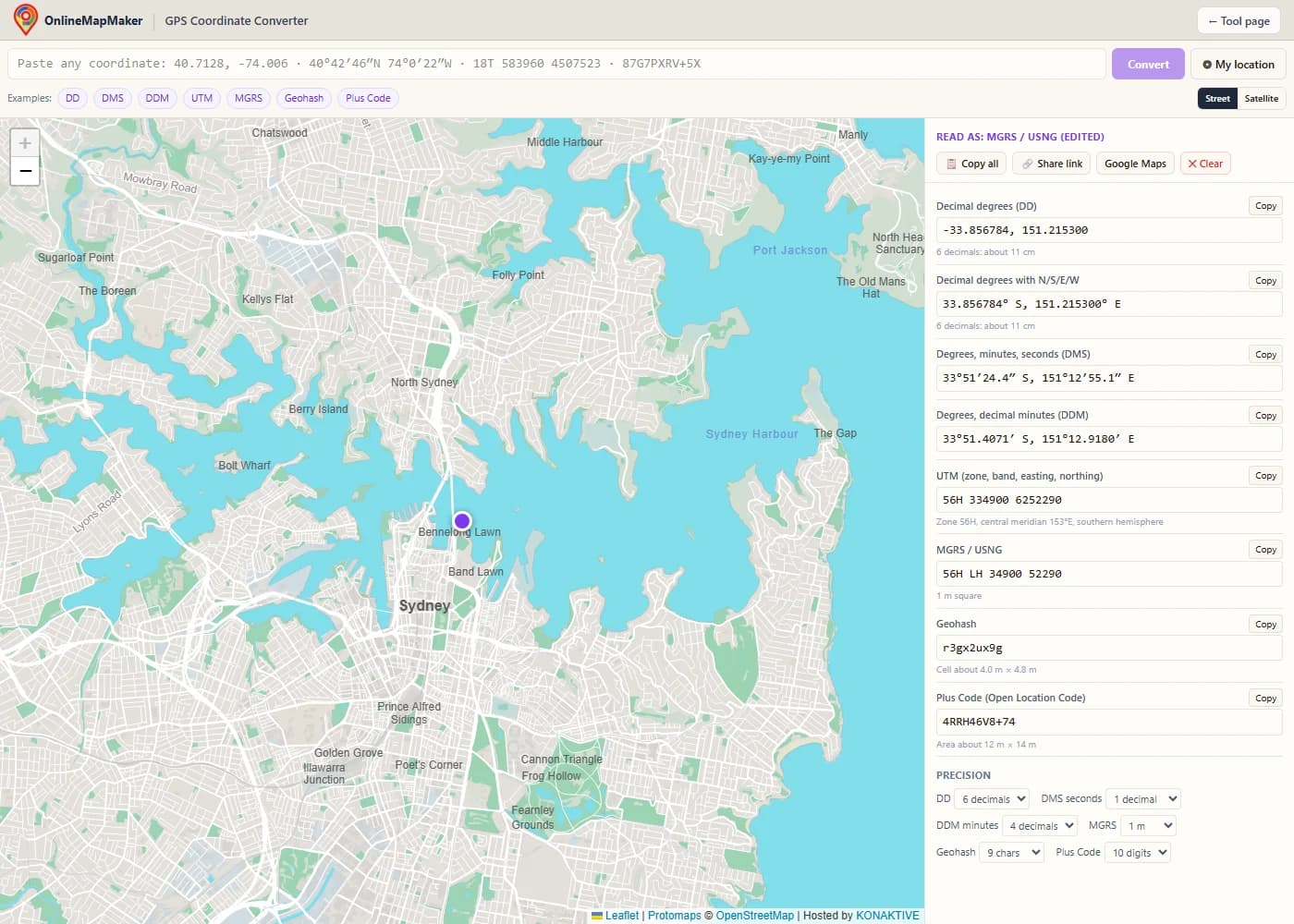
Type into any row and press Enter. Here the MGRS row gets "56H LH 34900 52290", and the map jumps to the Sydney Opera House, while the other rows show the same point in every other format.
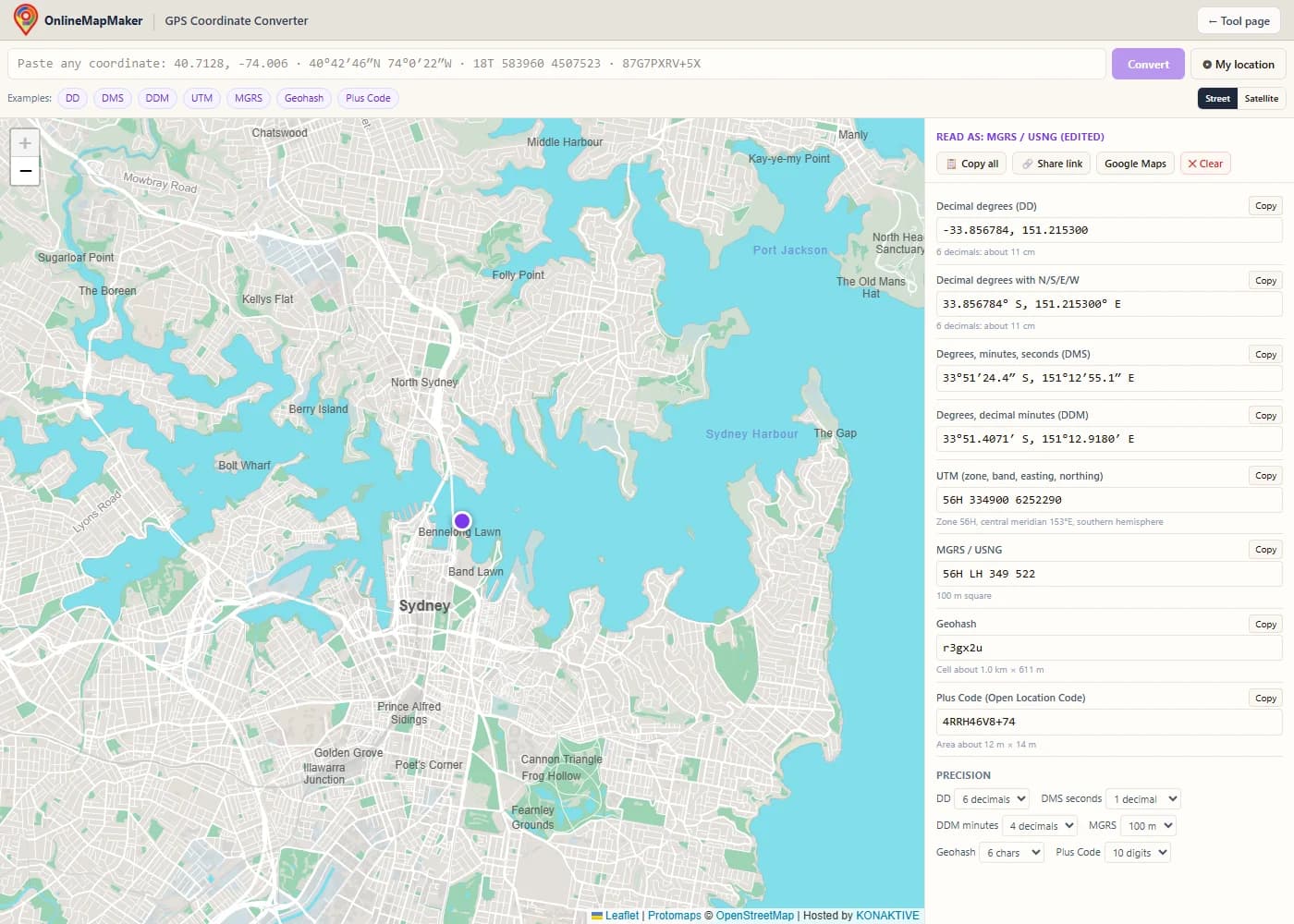
Under Precision, choose how many decimals or digits each format shows. Here MGRS is set to 100 m and the geohash to 6 characters. The small line under each row tells you how big that cell or square is.
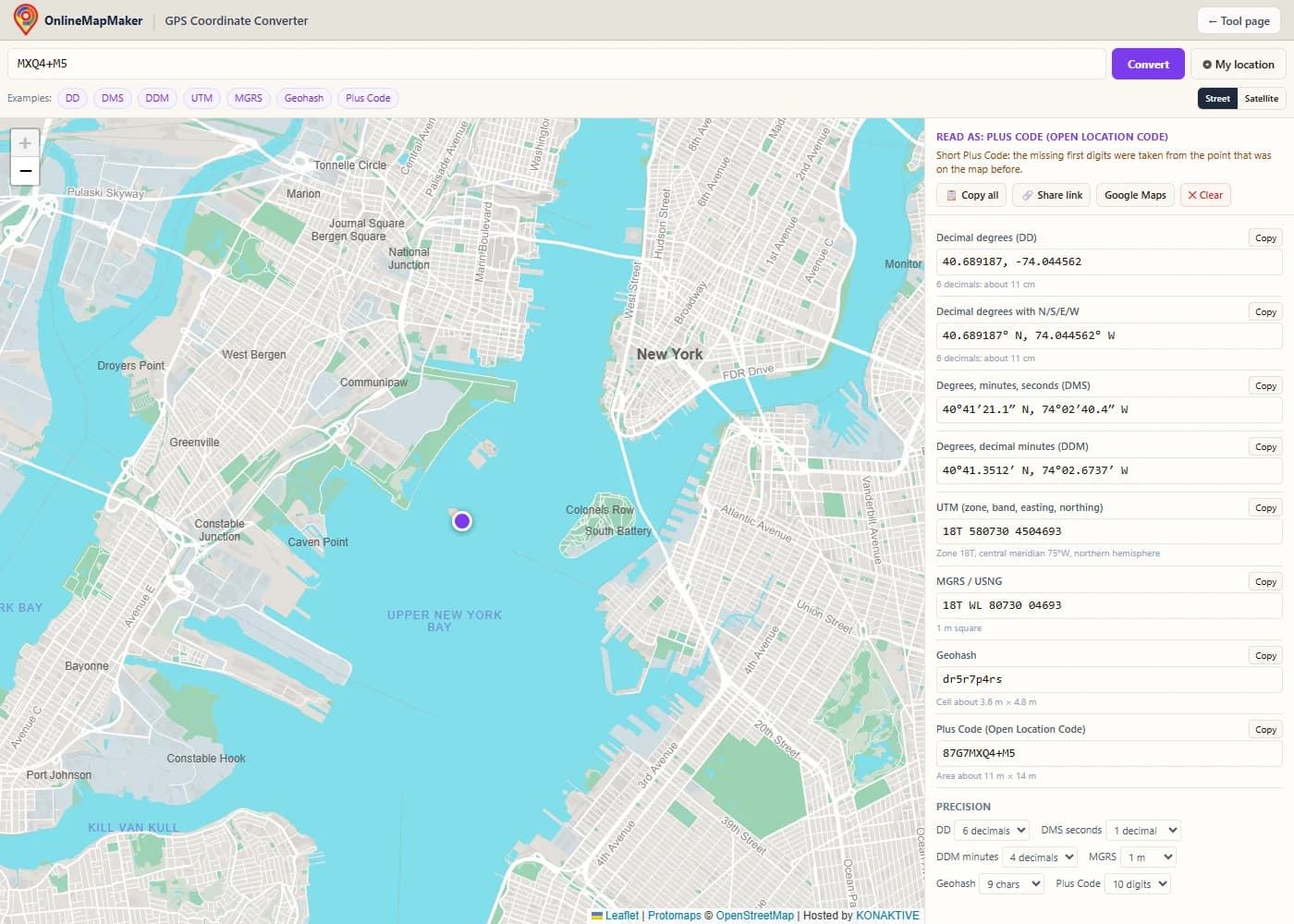
A short Plus Code such as "MXQ4+M5" leaves out its first four digits. The converter takes them from the point that was on the map before, as the Plus Code rules say, and explains this in a note.
How many decimals do you need?
More digits means a smaller area, but more digits than your GPS can measure only pretend to be precise. This table shows what each step means on the ground.
| Format and precision | Size on the ground | Good for |
|---|---|---|
| DD, 2 decimals | about 1.1 km | A town or a district |
| DD, 4 decimals | about 11 m | A house or a field |
| DD, 5 decimals | about 1.1 m | A phone GPS reading |
| DD, 6 decimals | about 11 cm | Survey work, the usual maximum |
| DMS, whole seconds | about 31 m | Paper maps, aviation charts |
| DMS, 0.1 second | about 3.1 m | GPS waypoints |
| DDM, 0.001 minute | about 1.9 m | Geocaching, marine charts |
| MGRS, 5 + 5 digits | 1 m square | Exact positions |
| MGRS, 3 + 3 digits | 100 m square | Military and rescue reports |
| Geohash, 9 characters | about 4.8 × 4.8 m at the equator | App and database lookups |
| Plus Code, 10 digits | about 14 × 14 m at the equator | A building entrance |
| Plus Code, 11 digits | about 3.5 × 2.8 m at the equator | A door or a parking spot |
Sizes in the east-west direction shrink toward the poles, because the lines of longitude come closer together. The tool shows the real size at your point under each row.
How each conversion works
All seven formats describe the same WGS84 point, the reference system that GPS uses. Here is the math behind each one, with the Statue of Liberty as the worked example.
DMS to decimal degrees, and back
To convert degrees, minutes and seconds to decimal, divide the minutes by 60 and the seconds by 3,600, and add them to the degrees. South and west become negative. To go back, take the whole degrees, multiply the rest by 60 for the minutes, and multiply the rest again by 60 for the seconds:
DMS → DD:  40°41′21.3″ N  =  40 + 41/60 + 21.3/3600
                          =  40 + 0.683333 + 0.005917
                          =  40.689250

DD → DMS:  40.689247
           0.689247 × 60  =  41.35482   →  41′
           0.35482 × 60   =  21.29″     →  40°41′21.3″ N
The tool rounds the seconds only at the end and carries the overflow, so a value never ends in "60″". Degrees and decimal minutes work the same way, with one step less: 0.689247 × 60 = 41.3548′.
UTM: zones and meters
UTM splits the Earth into 60 zones, each 6° of longitude wide, numbered east from 180°W. Inside each zone, a transverse Mercator projection turns latitude and longitude into meters. The central meridian of the zone gets an easting of 500,000 m, and the equator a northing of 0 m (or 10,000,000 m in the southern hemisphere, so northings are never negative):
zone             = floor((longitude + 180) / 6) + 1
                 = floor((−74.044502 + 180) / 6) + 1  =  18
central meridian = zone × 6 − 183  =  −75°  (75° W)
scale factor     = 0.9996 on the central meridian

Statue of Liberty:  18T 580735 4504700
  580735 − 500000 = 80,735 m east of the central meridian
  4,504,700 m north of the equator
The letter after the zone is the latitude band (C to X, 8° each). Two areas break the 6° rule: zone 32V is widened over southwest Norway, and Svalbard uses only zones 31X, 33X, 35X and 37X. The converter follows both. In a test with 20,000 random points, its UTM values matched the proj4 library within 0.87 mm.
MGRS: 100 km squares
MGRS takes the UTM zone and band, then names the 100 km square with two letters: a column letter from the easting and a row letter from the northing. What is left are the meters inside that square. The digits are cut off, never rounded, so a point is always inside the square that its reference names:
UTM:   18T 580735 4504700
MGRS:  18T  WL  80735  04700
            ││   └── meters east and north inside the square
            │└── row letter (from the northing)
            └── column letter (from the easting)

Precision: 5+5 digits = 1 m, 4+4 = 10 m, 3+3 = 100 m (18T WL 807 047)
USNG, the US National Grid, uses the same letters and numbers as MGRS on the WGS84 and NAD83 datums, so the converter's MGRS row is also a valid USNG reference.
Geohash: halving the world
A geohash halves the world again and again. Each step adds one bit: 1 if the point is in the upper (or eastern) half, 0 if in the lower (or western) half, taking longitude and latitude in turns. Every 5 bits become one character from the alphabet 0123456789bcdefghjkmnpqrstuvwxyz:
dr5r7p62n  →  9 characters = 45 bits
                23 bits for longitude, 22 for latitude
cell size     ≈  4.8 m × 4.8 m at the equator
                 (3.6 m × 4.8 m at 40.7° N)

dr5r7     →  a 5-character cell of about 4.9 × 4.9 km at the equator
Because each character only narrows the cell, two places that share the first characters are close together. That is why databases use geohashes for fast "what is near me" searches.
Plus Codes: base 20 grids
A Plus Code uses the 20 characters 23456789CFGHJMPQRVWX. The first pair splits the world into 20° squares, and each following pair splits the square by 20 again. After 8 digits comes the "+", and the 10th digit gives a square of about 14 × 14 m. An 11th digit divides that square into a 4 × 5 grid:
87G7MXQ4+M5
pair 1  87  →  20° square       pair 4  Q4  →  0.0025° (≈ 278 m)
pair 2  G7  →  1° square        pair 5  M5  →  0.000125° (≈ 14 m)
pair 3  MX  →  0.05° square

short code  MXQ4+M5  =  87G7MXQ4+M5 without the first 4 digits
A short code drops the first digits and needs a nearby reference place to be complete. The converter uses the point that was on the map before as that reference and picks the nearest matching square, exactly as the Open Location Code specification describes.
Who needs a coordinate converter
These are the most common reasons to convert GPS coordinates from one format to another.
- Hiking and outdoor GPS. Copy a point from Google Maps in decimal degrees and convert it to DDM or UTM for a Garmin or a paper topo map, or the other way round.
- Geocaching. Geocache listings give coordinates in degrees and decimal minutes, like
N 40° 41.355 W 074° 02.670. Paste them here to see the spot on the map or get decimal degrees for your phone. - Search and rescue, military and emergency services. Teams report positions in MGRS or USNG. Convert a caller's phone coordinates to an MGRS reference, or an MGRS report back to latitude and longitude.
- Aviation and boating. Charts and flight plans use DMS or DDM. Convert waypoints between them without doing the minute and second math by hand.
- Surveying and GIS. Field data in UTM meters often has to go into a web map that wants decimal degrees. The UTM row gives the zone, band and central meridian, too.
- Developers and data work. Check a geohash from a database, see the cell it covers, or get the Plus Code for an address that has no street name.
Frequently asked questions
Short answers to the questions people ask most about converting coordinates.
1. How do I convert DMS to decimal degrees?
Paste the DMS value, for example 40°41′21.3″N 74°02′40.2″W, into the box and press Convert. The decimal degrees row shows 40.689250, -74.044500. By hand: degrees + minutes ÷ 60 + seconds ÷ 3,600, with a minus sign for south and west.
2. How do I convert decimal degrees to DMS?
Paste the decimal value, for example 40.689247, -74.044502, and read the DMS row: 40°41′21.3″ N, 74°02′40.2″ W. Under Precision you can show the seconds with 0 to 3 decimals.
3. What is the difference between DMS and DDM?
DMS splits each degree into minutes and seconds (40°41′21.3″). DDM stops at minutes and gives them decimals (40°41.355′). Both are exact; they only write the fraction of a degree in a different way. Garmin devices and geocaching use DDM by default.
4. Which symbols and styles can I paste?
The converter reads the degree sign or "d", straight and curly quotes or the ′ and ″ signs, hemisphere letters before or after the numbers, minus signs, commas or spaces between latitude and longitude, and words like "latitude" and "north". Without letters, the first number is read as the latitude.
5. How many decimal places should I use?
Five decimals of a degree are about 1.1 m, which is what a phone GPS can measure. Six decimals (about 11 cm) is the usual maximum for survey work. More digits do not make a GPS reading more accurate. The precision table above lists the size of each step.
6. Why does UTM or MGRS show nothing near the poles?
UTM and MGRS are defined only from 80°S to 84°N. The polar areas use another system, UPS (Universal Polar Stereographic), which this converter does not cover. The other five formats work everywhere on Earth.
7. What does the letter after the UTM zone mean?
It is the latitude band, from C in the south to X in the north, 8° each. Some people write N or S for the hemisphere instead, and that clashes with bands N and S. The converter reads "S" as band S when the northing fits that band (32° to 40° N), and as southern hemisphere otherwise, and tells you which it chose. To be sure, write the word, for example "33 south 337000 6250000".
8. Is MGRS the same as USNG?
For points in the United States, yes in practice. The US National Grid uses the same zones, letters and digits as MGRS, so "18T WL 80735 04700" means the same spot in both.
9. What is a short Plus Code, and why does it need a reference?
Google Maps often shows codes like "MXQ4+M5 New York", which leave out the first four digits. Without them, the same short code exists in many places. The converter fills them in from the point that was on the map before, so click near the right city first, then paste the short code.
10. Which datum does the converter use?
WGS84, the datum of GPS, Google Maps and most web maps. In North America, NAD83 coordinates differ from WGS84 by about 1 to 2 m, which is fine for most uses. For other local datums, convert them to WGS84 first, for example with the Gauss-Krüger converter for German data.
11. Is anything I type sent to a server?
No. All parsing and conversion runs in your browser, in code you can check. Only the map tiles come from the basemap servers: they learn which map area is on screen, but never receive the coordinates you type. The share link holds the point in its address, so only people you send it to see it.
12. Can I paste coordinates from Google Maps?
Yes. In Google Maps, right-click a place and click the coordinates at the top of the menu to copy them, then paste them here. You can also paste a Plus Code from a Google Maps place page, as a full or a short code.
Standards and credits
The converter follows published standards. No coordinate library or web service is called; the formulas are written into the page itself.
- NGA: Universal Grids (UTM, MGRS), NGA.SIG.0012 · Public domain (U.S. Government)The UTM and MGRS definitions: zones, latitude bands, 100 km square letters, and the Norway and Svalbard zone exceptions.
- Open Location Code (Plus Codes) specification · Apache-2.0The Plus Code algorithm: encoding, decoding and the recovery of short codes, written from the open specification.
- Geohash, Gustavo Niemeyer · Public domainThe geohash algorithm, which its inventor released into the public domain in 2008.
- Leaflet 1.9 · BSD-2-ClauseDraws the interactive map and the draggable marker.
- Protomaps (hosted by KONAKTIVE), CARTO, OpenStreetMap · ODbL data, provider termsThe street basemap: Protomaps vector tiles hosted by KONAKTIVE, with CARTO and OpenStreetMap as backups.
- Esri World Imagery · Esri terms of useThe satellite basemap.
The UTM and MGRS results were checked against the proj4 and mgrs libraries with 20,000 random points before release, and the Plus Codes against the official test values.
Related tools
Coordinates are converted on the WGS84 datum. For legal survey work, check the result with the datum and projection your authority requires. Map tiles © OpenStreetMap contributors, drawn with Protomaps (hosted by KONAKTIVE), with CARTO as the fallback. Satellite imagery: Esri. All calculations run in your browser, and nothing you enter is stored on a server.